Résultats des élections législatives de la commune de Mont-Saint-Jean:
3ème circonscription |
Code postal 02360
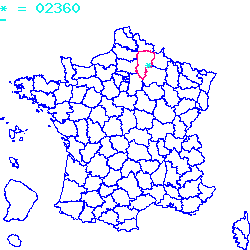
Localisé au nord de la France, le code postal 02360 est composé du numéro 02 correspondant au département Aisne et de l'identifiant du bureau postal 360.
Le code postal 02360 appartient à 18 villes qui sont listées dans le tableau ci-dessous :
| Code postal | Ville | Code Insee |
|---|---|---|
| 02360 | Mont-Saint-Jean | 02522 |
| 02360 | Morgny-en-Thiérache | 02526 |
| 02360 | Brunehamel | 02126 |
| 02360 | Chéry-lès-Rozoy | 02181 |
| 02360 | Saint-Clément | 02674 |
| 02360 | Archon | 02021 |
| 02360 | Parfondeval | 02586 |
| 02360 | Autels | 02038 |
| 02360 | Dolignon | 02266 |
| 02360 | Rozoy-sur-Serre | 02666 |
| 02360 | Coingt | 02204 |
| 02360 | Dohis | 02265 |
| 02360 | Raillimont | 02634 |
| 02360 | Cuiry-lès-Iviers | 02251 |
| 02360 | Grandrieux | 02354 |
| 02360 | Rouvroy-sur-Serre | 02660 |
| 02360 | Résigny | 02642 |
| 02360 | Iviers | 02388 |

Le code postal 02360 correspond aux villes suivantes : Iviers, Résigny, Rouvroy-sur-Serre, Grandrieux, Cuiry-lès-Iviers, Raillimont, Dohis, Coingt, Rozoy-sur-Serre, Dolignon, Autels, Parfondeval, Archon, Saint-Clément, Chéry-lès-Rozoy, Brunehamel, Morgny-en-Thiérache, Mont-Saint-Jean. Les 18 communes sont situées dans le nord de la France dans le département Aisne de la région des Hauts-De-France. Les codes INSEE, usuellement nommés codes communes, sont respectivement :
02388, 02642, 02660, 02354, 02251, 02634, 02265, 02204, 02666, 02266, 02038, 02586, 02021, 02674, 02181, 02126, 02526, 02522.
Les villes situées géographiquement près du code postal 02360 :
Besmont (02500), Beaumé (02500), Leuze (02500), Martigny (02500), Villes proches du code postal 02360
Plan et carte : Localiser le code postal 02360
Données démographiques sur le code postal 02360
1999
2010
2012
Population
Mont-Saint-Jean76
80
100
Densité
Mont-Saint-Jean1 914,36
2 015,11
2 518,89
Population
Morgny-en-Thiérache96
110
100
Densité
Morgny-en-Thiérache1 373,39
1 573,68
1 430,62
Population
Brunehamel509
538
500
Densité
Brunehamel5 719,10
6 044,94
5 617,98
Population
Chéry-lès-Rozoy114
105
100
Densité
Chéry-lès-Rozoy2 410,15
2 219,87
2 114,16
Population
Saint-Clément59
51
100
Densité
Saint-Clément1 177,64
1 017,96
1 996,01
Population
Archon84
87
100
Densité
Archon1 318,68
1 365,78
1 569,86
Population
Parfondeval149
155
200
Densité
Parfondeval1 365,72
1 420,71
1 833,18
Population
Autels74
74
100
Densité
Autels1 235,39
1 235,39
1 669,45
Population
Dolignon46
59
100
Densité
Dolignon1 360,95
1 745,56
2 958,58
Population
Rozoy-sur-Serre1079
1025
1000
Densité
Rozoy-sur-Serre6 527,53
6 200,85
6 049,61
Population
Coingt73
77
100
Densité
Coingt998,63
1 053,35
1 367,99
Population
Dohis111
92
100
Densité
Dohis1 370,37
1 135,80
1 234,57
Population
Raillimont77
90
100
Densité
Raillimont1 571,43
1 836,73
2 040,82
Population
Cuiry-lès-Iviers40
37
0
Densité
Cuiry-lès-Iviers835,07
772,44
0,00
Population
Grandrieux97
88
100
Densité
Grandrieux2 229,89
2 022,99
2 298,85
Population
Rouvroy-sur-Serre51
44
0
Densité
Rouvroy-sur-Serre1 307,69
1 128,21
0,00
Population
Résigny208
175
200
Densité
Résigny2 656,45
2 234,99
2 554,28
Population
Iviers172
210
200
Densité
Iviers2 308,72
2 818,79
2 684,56
Données géographiques se rapportant au code postal 02360
Nom et code commune
Superficie
Longitude
Latitude
Mont-Saint-Jean
025220.0397
4.2
49.7833
Morgny-en-Thiérache
025260.0699
4.06667
49.7667
Brunehamel
021260.089
4.18333
49.7667
Chéry-lès-Rozoy
021810.0473
4.08333
49.7167
Saint-Clément
026740.0501
4.06667
49.7667
Archon
020210.0637
4.11667
49.7417
Parfondeval
025860.1091
4.16667
49.7333
Autels
020380.0599
4.2257
49.7667
Dolignon
022660.0338
4.08333
49.7167
Rozoy-sur-Serre
026660.1653
4.13333
49.7167
Coingt
022040.0731
4.08333
49.7833
Dohis
022650.081
4.13333
49.75
Raillimont
026340.049
4.15
49.7083
Cuiry-lès-Iviers
022510.0479
4.10973
49.7614
Grandrieux
023540.0435
4.18333
49.7333
Rouvroy-sur-Serre
026600.039
4.16667
49.7167
Résigny
026420.0783
4.2
49.7333
Iviers
023880.0745
4.13333
49.7833
Météo à Mont-Saint-Jean / 02360


 Mairie Mont-Saint-Jean
  Villes voisines au 02360
 Carte et plan 02360