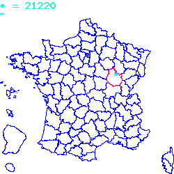
Résultats des élections législatives de la commune de Semezanges:
5ème circonscription |
Code postal 21220
Localisé au centre-est de la France, le code postal 21220 est composé du numéro 21 correspondant au département Côte-d'Or et de l'identifiant du bureau postal 220.
Le code postal 21220 appartient à 24 villes qui sont listées dans le tableau ci-dessous :
| Code postal | Ville | Code Insee |
|---|---|---|
| 21220 | Semezanges | 21601 |
| 21220 | Chambolle-Musigny | 21133 |
| 21220 | Clémencey | 21178 |
| 21220 | Chambœf | 21132 |
| 21220 | Broindon | 21113 |
| 21220 | Fixin | 21265 |
| 21220 | Reulle-Vergy | 21523 |
| 21220 | Gevrey-Chambertin | 21295 |
| 21220 | Quemigny-Poisot | 21513 |
| 21220 | Épernay-sous-Gevrey | 21246 |
| 21220 | Brochon | 21110 |
| 21220 | Détain-et-Bruant | 21228 |
| 21220 | Segrois | 21597 |
| 21220 | Morey-Saint-Denis | 21442 |
| 21220 | L'Étang-Vergy | 21254 |
| 21220 | Ternant | 21625 |
| 21220 | Messanges | 21407 |
| 21220 | Urcy | 21650 |
| 21220 | Curtil-Vergy | 21219 |
| 21220 | Bévy | 21070 |
| 21220 | Chevannes | 21169 |
| 21220 | Curley | 21217 |
| 21220 | Saint-Philibert | 21565 |
| 21220 | Collonges-lès-Bévy | 21182 |

Le code postal 21220 correspond aux villes suivantes : Collonges-lès-Bévy, Saint-Philibert, Curley, Chevannes, Bévy, Curtil-Vergy, Urcy, Messanges, Ternant, L'Étang-Vergy, Morey-Saint-Denis, Segrois, Détain-et-Bruant, Brochon, Épernay-sous-Gevrey, Quemigny-Poisot, Gevrey-Chambertin, Reulle-Vergy, Fixin, Broindon, Chambœf, Clémencey, Chambolle-Musigny, Semezanges. Les 24 communes sont situées dans le centre-est de la France dans le département Côte-d'Or de la région de la Bourgogne-Franche-Comté. Les codes INSEE, usuellement nommés codes communes, sont respectivement :
21182, 21565, 21217, 21169, 21070, 21219, 21650, 21407, 21625, 21254, 21442, 21597, 21228, 21110, 21246, 21513, 21295, 21523, 21265, 21113, 21132, 21178, 21133, 21601.
Les villes situées géographiquement près du code postal 21220 :
Arcenant (21700), Villars-Fontaine (21700), Meuilley (21700), Marey-lès-Fussey (21700), Fussey (21700), Chaux (21700), Échevronne (21420), Gergueil (21410), Villers-la-Faye (21700), Villes proches du code postal 21220
Code postal
Ville
Superficie
Densité
Population
21700 Arcenant 0.1012 km2 49 500 21700 Villars-Fontaine 0.0289 km2 43 100 21700 Meuilley 0.061 km2 75 500 21700 Marey-lès-Fussey 0.0397 km2 16 100 21700 Fussey 0.0773 km2 14 100 21700 Chaux 0.0704 km2 63 400 21420 Échevronne 0.0869 km2 32 300 21410 Gergueil 0.0993 km2 13 100 21700 Villers-la-Faye 0.0584 km2 69 400 km2 km2 Plan et carte : Localiser le code postal 21220
Données démographiques sur le code postal 21220
1999
2010
2012
Population
Semezanges112
104
100
Densité
Semezanges1 375,92
1 277,64
1 228,50
Population
Chambolle-Musigny313
313
300
Densité
Chambolle-Musigny4 134,74
4 134,74
3 963,01
Population
Clémencey92
120
100
Densité
Clémencey858,21
1 119,40
932,84
Population
Chambœf268
331
300
Densité
Chambœf2 382,22
2 942,22
2 666,67
Population
Broindon61
122
100
Densité
Broindon1 314,66
2 629,31
2 155,17
Population
Fixin784
757
800
Densité
Fixin7 747,04
7 480,24
7 905,14
Population
Reulle-Vergy99
120
100
Densité
Reulle-Vergy1 615,01
1 957,59
1 631,32
Population
Gevrey-Chambertin3259
3061
3100
Densité
Gevrey-Chambertin13 157,04
12 357,69
12 515,14
Population
Quemigny-Poisot187
197
200
Densité
Quemigny-Poisot1 651,94
1 740,28
1 766,78
Population
Épernay-sous-Gevrey162
183
200
Densité
Épernay-sous-Gevrey2 961,61
3 345,52
3 656,31
Population
Brochon689
644
600
Densité
Brochon9 235,92
8 632,71
8 042,90
Population
Détain-et-Bruant108
150
100
Densité
Détain-et-Bruant697,67
968,99
645,99
Population
Segrois54
48
100
Densité
Segrois2 358,08
2 096,07
4 366,81
Population
Morey-Saint-Denis671
697
700
Densité
Morey-Saint-Denis8 569,60
8 901,66
8 939,97
Population
L'Étang-Vergy183
201
200
Densité
L'Étang-Vergy6 905,66
7 584,91
7 547,17
Population
Ternant72
105
100
Densité
Ternant440,37
642,20
611,62
Population
Messanges194
240
200
Densité
Messanges6 360,66
7 868,85
6 557,38
Population
Urcy117
159
100
Densité
Urcy1 475,41
2 005,04
1 261,03
Population
Curtil-Vergy85
116
100
Densité
Curtil-Vergy3 148,15
4 296,30
3 703,70
Population
Bévy91
95
100
Densité
Bévy1 730,04
1 806,08
1 901,14
Population
Chevannes113
133
100
Densité
Chevannes1 796,50
2 114,47
1 589,83
Population
Curley118
144
100
Densité
Curley2 052,17
2 504,35
1 739,13
Population
Saint-Philibert410
446
400
Densité
Saint-Philibert8 686,44
9 449,15
8 474,58
Population
Collonges-lès-Bévy78
94
100
Densité
Collonges-lès-Bévy1 447,12
1 743,97
1 855,29
Données géographiques se rapportant au code postal 21220
Nom et code commune
Superficie
Longitude
Latitude
Semezanges
216010.0814
4.85834
47.2153
Chambolle-Musigny
211330.0757
4.95
47.1833
Clémencey
211780.1072
4.88333
47.25
Chambœf
211320.1125
4.9
47.2333
Broindon
211130.0464
5.05
47.2
Fixin
212650.1012
4.96667
47.25
Reulle-Vergy
215230.0613
4.9
47.1833
Gevrey-Chambertin
212950.2477
4.95
47.2333
Quemigny-Poisot
215130.1132
4.86667
47.2333
Épernay-sous-Gevrey
212460.0547
5.03333
47.1833
Brochon
211100.0746
4.96667
47.2333
Détain-et-Bruant
212280.1548
4.78333
47.1667
Segrois
215970.0229
4.9
47.1667
Morey-Saint-Denis
214420.0783
4.96667
47.2
L'Étang-Vergy
212540.0265
4.88333
47.1833
Ternant
216250.1635
4.85
47.2
Messanges
214070.0305
4.8725
47.1623
Urcy
216500.0793
4.85
47.2667
Curtil-Vergy
212190.027
4.88333
47.1667
Bévy
210700.0526
4.85
47.1833
Chevannes
211690.0629
4.84806
47.1584
Curley
212170.0575
4.91667
47.2
Saint-Philibert
215650.0472
5.01667
47.2
Collonges-lès-Bévy
211820.0539
4.85
47.1667
Météo à Semezanges / 21220


 Mairie Semezanges
  Villes voisines au 21220
 Carte et plan 21220