Résultats des élections législatives de la commune de Saint-Vincent-la-Commanderie:
4ème circonscription |
Code postal 26300
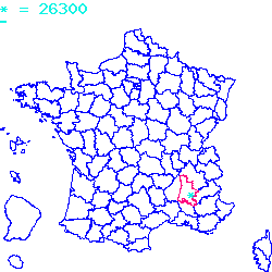
Localisé au sud-est de la France, le code postal 26300 est composé du numéro 26 correspondant au département Drôme et de l'identifiant du bureau postal 300.
Le code postal 26300 appartient à 12 villes qui sont listées dans le tableau ci-dessous :
| Code postal | Ville | Code Insee |
|---|---|---|
| 26300 | Saint-Vincent-la-Commanderie | 26382 |
| 26300 | Chatuzange-le-Goubet | 26088 |
| 26300 | Châteauneuf-sur-Isère | 26084 |
| 26300 | Charpey | 26079 |
| 26300 | Bésayes | 26049 |
| 26300 | Beauregard-Baret | 26039 |
| 26300 | Alixan | 26004 |
| 26300 | Jaillans | 26381 |
| 26300 | Marches | 26173 |
| 26300 | Bourg-de-Péage | 26057 |
| 26300 | Barbières | 26023 |
| 26300 | Rochefort-Samson | 26273 |

Le code postal 26300 correspond aux villes suivantes : Rochefort-Samson, Barbières, Bourg-de-Péage, Marches, Jaillans, Alixan, Beauregard-Baret, Bésayes, Charpey, Châteauneuf-sur-Isère, Chatuzange-le-Goubet, Saint-Vincent-la-Commanderie. Les 12 communes sont situées dans le sud-est de la France dans le département Drôme de la région de l'Auvergne-Rhône-Alpes. Les codes INSEE, usuellement nommés codes communes, sont respectivement :
26273, 26023, 26057, 26173, 26381, 26004, 26039, 26049, 26079, 26084, 26088, 26382.
Les villes situées géographiquement près du code postal 26300 :
Peyrus (26120), Hostun (26730), Léoncel (26190), Châteaudouble (26120), Saint-Paul-lès-Romans (26750), Le Chaffal (26190), Eymeux (26730), Châtillon-Saint-Jean (26750), La Baume-d'Hostun (26730), Omblèze (26400), Combovin (26120).Villes proches du code postal 26300
Code postal
Ville
Superficie
Densité
Population
26120 Peyrus 0.1048 km2 60 600 26730 Hostun 0.1824 km2 52 1000 26190 Léoncel 0.4301 km2 1 0 26120 Châteaudouble 0.1737 km2 32 500 26750 Saint-Paul-lès-Romans 0.1577 km2 111 1700 26190 Le Chaffal 0.1158 km2 4 0 26730 Eymeux 0.0988 km2 101 900 26750 Châtillon-Saint-Jean 0.0882 km2 133 1200 26730 La Baume-d'Hostun 0.0846 km2 64 500 26400 Omblèze 0.4492 km2 1 100 26120 Combovin 0.3586 km2 11 400 Plan et carte : Localiser le code postal 26300
Données démographiques sur le code postal 26300
1999
2010
2012
Population
Saint-Vincent-la-Commanderie391
413
400
Densité
Saint-Vincent-la-Commanderie2 931,03
3 095,95
2 998,50
Population
Chatuzange-le-Goubet3976
4733
4600
Densité
Chatuzange-le-Goubet14 079,32
16 759,92
16 288,95
Population
Châteauneuf-sur-Isère3285
3807
3700
Densité
Châteauneuf-sur-Isère7 208,69
8 354,18
8 119,38
Population
Charpey908
1276
1200
Densité
Charpey5 865,63
8 242,89
7 751,94
Population
Bésayes911
1103
1000
Densité
Bésayes9 559,29
11 573,98
10 493,18
Population
Beauregard-Baret543
792
800
Densité
Beauregard-Baret2 316,55
3 378,84
3 412,97
Population
Alixan2079
2408
2300
Densité
Alixan7 351,49
8 514,85
8 132,96
Population
Jaillans597
871
800
Densité
Jaillans6 603,98
9 634,96
8 849,56
Population
Marches655
751
700
Densité
Marches5 906,22
6 771,87
6 311,99
Population
Bourg-de-Péage9770
10128
10100
Densité
Bourg-de-Péage71 261,85
73 873,09
73 668,85
Population
Barbières647
834
800
Densité
Barbières4 493,06
5 791,67
5 555,56
Population
Rochefort-Samson759
948
900
Densité
Rochefort-Samson3 086,62
3 855,23
3 660,02
Données géographiques se rapportant au code postal 26300
Nom et code commune
Superficie
Longitude
Latitude
Saint-Vincent-la-Commanderie
263820.1334
5.11667
44.9333
Chatuzange-le-Goubet
260880.2824
5.08333
45
Châteauneuf-sur-Isère
260840.4557
4.93473
45.0139
Charpey
260790.1548
5.1
44.9333
Bésayes
260490.0953
5.08333
44.9667
Beauregard-Baret
260390.2344
5.18333
44.9833
Alixan
260040.2828
5.03333
44.9667
Jaillans
263810.0904
5.18333
45.0333
Marches
261730.1109
5.1
44.9833
Bourg-de-Péage
260570.1371
5.05
45.0333
Barbières
260230.144
5.13333
44.95
Rochefort-Samson
262730.2459
5.15
44.9667
Météo à Saint-Vincent-la-Commanderie / 26300


 Mairie Saint-Vincent-la-Commanderie
  Villes voisines au 26300
 Carte et plan 26300