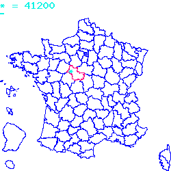
Résultats des élections législatives de la commune de Romorantin-Lanthenay:
2ème circonscription |
Code postal 41200
Localisé au cœur du Massif central, le code postal 41200 est composé du numéro 41 correspondant au département Loir-et-Cher et de l'identifiant du bureau postal 200.
Le code postal 41200 appartient à 6 villes qui sont listées dans le tableau ci-dessous :
| Code postal | Ville | Code Insee |
|---|---|---|
| 41200 | Romorantin-Lanthenay | 41194 |
| 41200 | Villeherviers | 41282 |
| 41200 | Villefranche-sur-Cher | 41280 |
| 41200 | Pruniers-en-Sologne | 41185 |
| 41200 | Millançay | 41140 |
| 41200 | Loreux | 41118 |

Le code postal 41200 correspond aux villes suivantes : Loreux, Millançay, Pruniers-en-Sologne, Villefranche-sur-Cher, Villeherviers, Romorantin-Lanthenay. Les 6 communes sont situées dans le cœur du Massif central dans le département Loir-et-Cher de la région de l'Auvergne-Rhône-Alpes. Les codes INSEE, usuellement nommés codes communes, sont respectivement :
41118, 41140, 41185, 41280, 41282, 41194.
Les villes situées géographiquement près du code postal 41200 :
Marcilly-en-Gault (41210), Selles-Saint-Denis (41300), Langon (41320), La Ferté-Beauharnais (41210), Saint-Julien-sur-Cher (41320), La Ferté-Imbault (41300), Saint-Loup (41320), Neung-sur-Beuvron (41210), Mennetou-sur-Cher (41320), Saint-Viâtre (41210), Châtres-sur-Cher (41320).Villes proches du code postal 41200
Code postal
Ville
Superficie
Densité
Population
41210 Marcilly-en-Gault 0.5031 km2 14 700 41300 Selles-Saint-Denis 0.5098 km2 24 1200 41320 Langon 0.3882 km2 21 800 41210 La Ferté-Beauharnais 0.0242 km2 221 500 41320 Saint-Julien-sur-Cher 0.1599 km2 46 800 41300 La Ferté-Imbault 0.5002 km2 19 1000 41320 Saint-Loup 0.147 km2 24 300 41210 Neung-sur-Beuvron 0.63 km2 19 1200 41320 Mennetou-sur-Cher 0.1626 km2 54 900 41210 Saint-Viâtre 0.8979 km2 14 1300 41320 Châtres-sur-Cher 0.3533 km2 30 1100 Plan et carte : Localiser le code postal 41200
Données démographiques sur le code postal 41200
1999
2010
2012
Population
Romorantin-Lanthenay18353
17027
17400
Densité
Romorantin-Lanthenay40 505,41
37 578,90
38 402,12
Population
Villeherviers498
492
500
Densité
Villeherviers1 280,21
1 264,78
1 285,35
Population
Villefranche-sur-Cher2413
2701
2600
Densité
Villefranche-sur-Cher8 861,55
9 919,21
9 548,29
Population
Pruniers-en-Sologne2123
2292
2300
Densité
Pruniers-en-Sologne4 842,61
5 228,10
5 246,35
Population
Millançay667
744
800
Densité
Millançay1 151,19
1 284,09
1 380,74
Population
Loreux255
236
200
Densité
Loreux851,42
787,98
667,78
Données géographiques se rapportant au code postal 41200
Nom et code commune
Superficie
Longitude
Latitude
Romorantin-Lanthenay
411940.4531
1.74361
47.3589
Villeherviers
412820.389
1.8
47.3667
Villefranche-sur-Cher
412800.2723
1.77
47.2934
Pruniers-en-Sologne
411850.4384
1.67111
47.3228
Millançay
411400.5794
1.76667
47.45
Loreux
411180.2995
1.83333
47.4
Météo à Romorantin-Lanthenay / 41200


 Mairie Romorantin-Lanthenay
  Villes voisines au 41200
 Carte et plan 41200